NASA’s Terra Spacecraft Sees Thailand Flooding
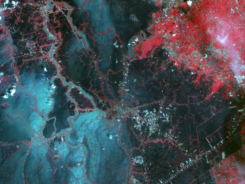
Since July 2011, heavy monsoon rains in southeast Asia have resulted in catastrophic flooding. In Thailand, about one third of all provinces are affected. On Oct. 23, 2011, when this image from ASTER, the Advanced Spaceborne Thermal Emission and Reflection Radiometer instrument on NASA’s Terra spacecraft was acquired, flood waters were approaching the capital city of Bangkok as the Ayutthaya River overflowed its banks. In this image, vegetation is displayed in red, and flooded areas are black and dark blue.
Brighter blue shows sediment-laden water, and gray areas are houses, buildings and roads. The image covers an area of 35.2 by 66.3 miles (56.7 by 106.9 kilometers) and is located at 14.5 degrees north latitude, 100.5 degrees east longitude.
Read more: Nasa.gov
NASA